Project Overview
A commercial and hospitality development on a hilly site, with cottages, landscaped terraces and pathways.
Wakna Development
Project details
Efficient design on steep terrain, with safe connectivity and local character.
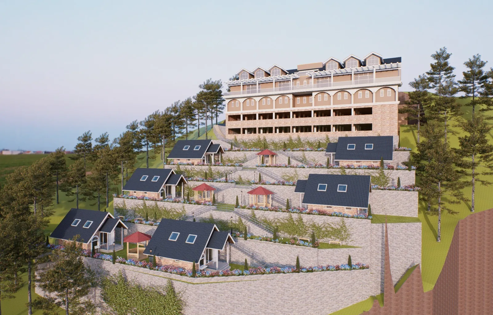
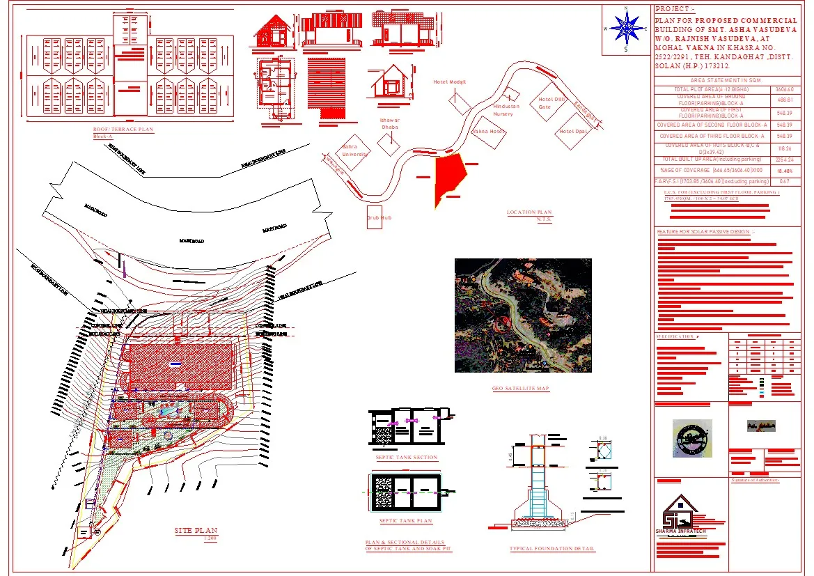
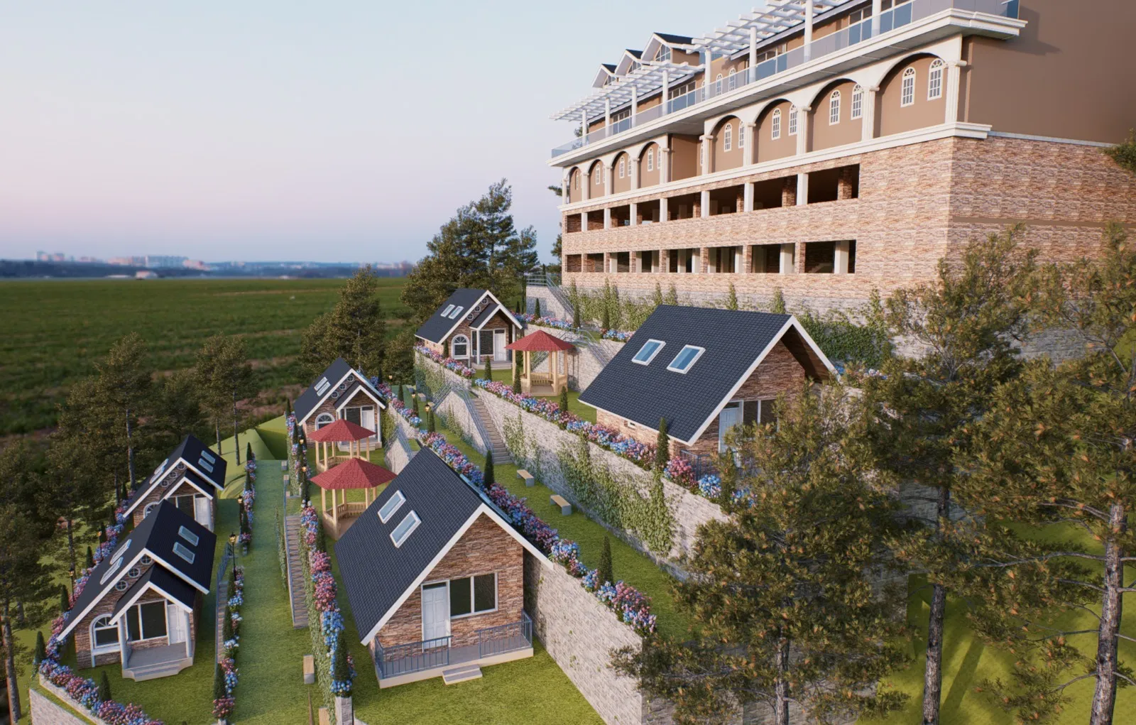
A commercial and hospitality development on a hilly site, with a multi-storey building, cottages, landscaped terraces, parking, and pedestrian pathways.
- Project name Proposed Commercial & Hospitality Development
- Location Wakna, Kandaghat, Solan, Himachal Pradesh
- Category Commercial / Hospitality
- Area 3,606.40 SQM
01 - Project Description
Commercial development on a hilly site with a multi-storey building, cottages, landscaped terraces, parking, and pedestrian pathways.
Surveying
Surveying the hilly site at Wakna, Kandaghat.
Planning & Designing
Planning and designing the building, cottages, parking and pathways.
Landscape Planning
Landscape planning for the terraces across the hilly site.
3D Visualization
3D visualization of the proposed development.
A closer look at the project

02 - Challenge & Approach
Designing on a steep Himachal hillside.
The Challenge
Designing efficiently on steep terrain while ensuring smooth circulation, safe connectivity, and an architectural character suited to Himachal's climate and landscape.
Our Approach
Let the terrain guide the layout, and plan circulation and connectivity around it.
- Efficient design on steep terrain
- Smooth circulation and safe connectivity
- Architectural character suited to Himachal's climate and landscape
03 - How we delivered it
From the survey to the 3D visuals.
-
1
Surveying
Surveying the hilly site at Wakna, Kandaghat.
-
2
Planning & Designing
Planning for smooth circulation and safe connectivity across the site.
-
3
Landscape Planning
Planning the landscaped terraces and pedestrian pathways.
-
4
3D Visualization
Visualizing the proposed development in 3D.
More of what we do
Planning a development on hilly terrain?
Let's talk about surveying, planning, landscape design and 3D visualization for your project.
Get in touch